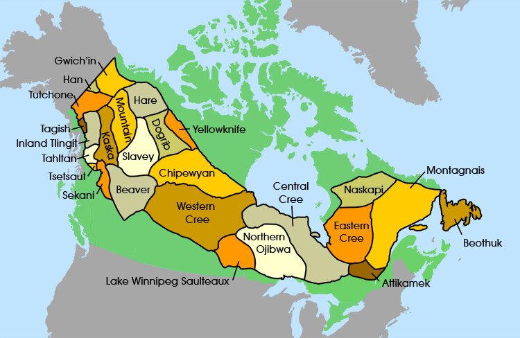
| The Dene |
| The Dene occupied the northern fringe of the boreal forest and the tundra from the Seal River to Great Slave Lake. |
| The Dogrib |
Dogrib People |
| Name |
The Dogrib, a Dene people, got their name from a Cree term for Athapascan speakers. |
| Location |
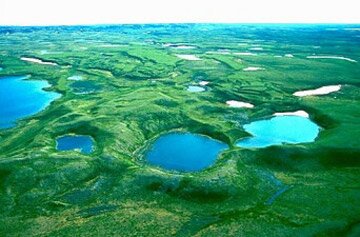
Their lands lay east of the Mackenzie River between Great Slave Lake and Great Bear Lake in the NWT |
| Language |
Athapascan |
| Hare |
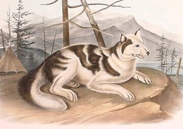
Hare Indian dog |
| Name |
Their name was given them by Europeans because of their dependence on the snowshoe hare for food and clothing. |
| Location |
They lived along the Mackenzie River valley of the Northwest Territories. |
| Language |
Athapascan |
| Mountain |
Mackenzie Mountain |
| Name |
Their name comes from their location beside the Mackenzie Mountains. |
| Location |
The Mountain Indians lived between the Mackenzie Mountains and the Mackenzie River, from the Redstone River to the Mountain River. |
| Language |
Athapascan |
| The Slavey |
Slavey People |
| Name |
The term Slavey was a Cree word meaning captive or, as a missionary Father Petitot indicated, timidity. |
| Location |
Slavey (Slave) were a major Dene group in the boreal forest region of the western Canadian Subarctic. Their mountainous land extended along the Slave, Athabasca and Mackenzie rivers south from Fort Nelson, BC, on the west and from the Hay Lakes region of Alberta on the east, north to a region near Tulita and the south shore of Great Bear Lake in the Northwest Territories. |
| Language |
Athapascan
They were related linguistically and culturally to the Hare, Gwitch’in, and Dogrib. |
| The Beaver |
Beaver People |
| Location |
The Beaver, lived just south of the Slavey people, along the Peace River. |
| Language |
Athapascan |
| Chipewyan |
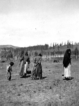
Chipewyan Hunters |
| Name |
Chipewyan is a term of Cree meaning "pointed skins," but the group used more specific names in their communities. The Chipewyan have also been called Caribou Eaters and Mountainees. |
| Location |
The Chipewyan lived in the northern portions of Manitoba, Saskatchewan, Alberta and the southern part of the NWT. |
| Language |
Athapascan |
| Peoples |
The Yellowknives Indians were absorbed into the Chipewyan Indians. |
|
| Tagish |
| Name |
Their name means "it (spring ice) is breaking up" in their language. |
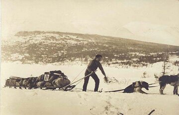
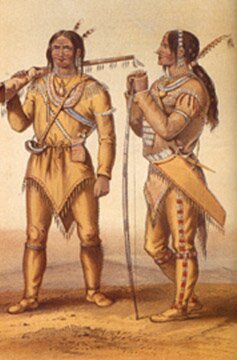
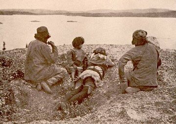
A Tagish man with his dogsled |
| Location |
They lived around the Tagish Lask and Marsh Lake in the Yukon. |
| Language |
Athapascan |
|
| Tahltan |
| Location |
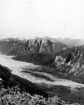
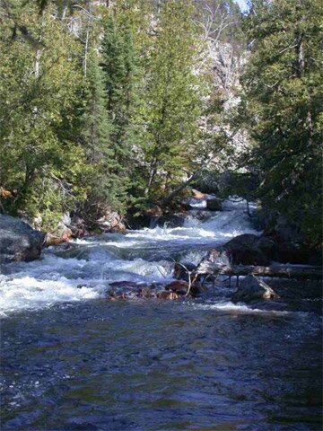
They lived in the drainage basin of the Stikine River. |
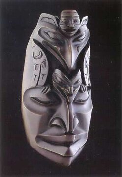
A Tahltan-Tlingit sculpture of their raven story |
| Language |
Athapascan |
|
| Kaska |
| Location |
They lived in the mountainous region drained by the Liard River in southern Yukon and Northern BC. |
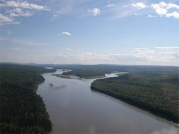
Liard River in BC |
| Language |
Athapascan |
|
| Sekani |
| Name |
They were "people of the rocks or mountains". |
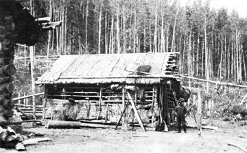
Bark lodge of the Sekani Indians |
| Location |
They lived in the Finlay and Parsnip River drainages of the Rocky Mountain Trench. They diverged from the Beaver in the late 18th century. |
| Language |
Athapascan |
|
| Tsetsaut |
| Name |
Their name was given to them by another tribe (the Gitksan); it is a Tsimshian word meaning "people of the interior". |
Portland canal |
| Location |
They mostly inhabited the area of the Portland Canal. They were a large tribe but were almost exterminated by other tribes (including the Tahltan) around 1830. Since then they have been assimilated into other tribes. |
| Language |
Athapascan - there are no longer any speakers of their Tsetsaut dialect of Athapascan. |
| Population |
In 1830 there were 500 of them; by 1895 there were only 12. |
|
| Gwich'in |
| Cool Fact |
Gwich'in knowledge of their environment was extensive; one anthropologist recorded 400 Gwich'in names for plants and animals. |
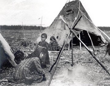
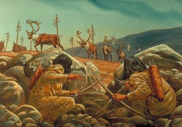
Gwich'in Hunters |
| Location |
The Gwich'in (formerly Kutchin), were the northernmost of all North American Indians, and occupied the land located primarily North of the Arctic Circle and extending across the Mackenzie drainage and northern tributaries of the Yukon River into northwest Alaska, bordering Inuit land. |
| Language |
Athapascan
Their language is incomprehensible to all others, except the Han.
|
|
| Han |
| Location |
The Han territory started at the Yukon-Alaska boundary, extending along the Yukon River from about 20 km south of Dawson northward to about 50 km south of Circle, Alaska |
Yukon River |
| Language |
Athapascan
Like many others, their speech was distinct and understood by few. |
|
| Tutchones |
| Location |
The Tutchones lived at the plateau located by the Alsek and Yukon River headwaters. Their southwest territories straddled the Coastal and St. Elias mountains and on the northeast, the Selwyn range. |
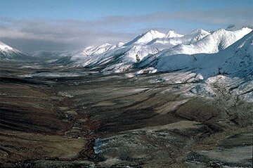
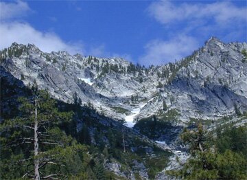
Ogilvie Mountains, Yukon |
| Language |
Athapascan |
|
| Northern Ojibwa |
| Location |
The Northern Ojibwa, who formed their own nation when the Ojibwa split between 1680 and 1800, occupied Northern Ontario along with some Cree tribes. |
Northern Ontario |
| Language |
Algonquian - Objibway |
|
| Attikamek |
| Name |
Also called Tête-de-Boule. |
Bouclier Region, Quebec |
| Location |
Their land, in the Bouclier region of Upper St. Maurice Rivière in Québec, was about 7000 km2 |
| Language |
Algonquian |
| Peoples |
The Attikamek or Tête-de-Boule had two major bands, the Kikendatch and the Weymontachie. |
| Population |
There were about 500 to 550 Attikameks back in the 1700s. |
|
| The Innu People |
| Name |
The Innu- or ‘the people’- were called the Montagnais (French for Mountains) and the Naskapi by other people. Their own name was 'Mushua Innuts', which means ‘Barren Land People.’ |
Innu People |
| Location |
The Innu People inhabited eastern Quebec and Labrador. |
| Language |
Algonquian |
|